Mission Gallery
Other
South Greenland Coast

Northeastern Disko Island

Nussuaq Peninsula

Infrared weather satellite image from this morning

Lower Kangerdlugssuaq Glacier and fjord

Landscape of southeastern Greenland

Nord Glacier calving front

Fjord wall in east Greenland

Calving front of Ikertivaq Glacier

Small glacier with moraines in southeast Greenland

Map of Southeast Glaciers 01

Summit Station, Greenland

Map of K-EGIG-Summit Flight

Kangerdlugssuaq Glacier calving front

Icebergs in Kangerdlugssuaq fjord

Cut the corner

Weather satellite image from this morning

Map of Sea Ice - South Canada Basin mission

Map of Sea Ice - South Basin Transect

Infrared satellite image from morning weather analysis

Map of Sea Ice - SIZRS Zigzag

Buildings near Barrow Alaska

Map of Sea Ice - North Beaufort Loop Mission

Young, thin ice off Banks Island

Finger rafting off Banks Island

Map of Sea Ice - East Beaufort Mission

Mission map for Sea Ice - Laxon Line

North Pole Sunrise

Station Nord from NASA-439

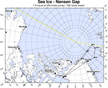
Map of Sea Ice - Nansen Gap Mission
Disclaimer: This material is being kept online for historical purposes. Though accurate at the time of publication, it is no longer being updated. The page may contain broken links or outdated information, and parts may not function in current web browsers. Visit https://espo.nasa.gov for information about our current projects.