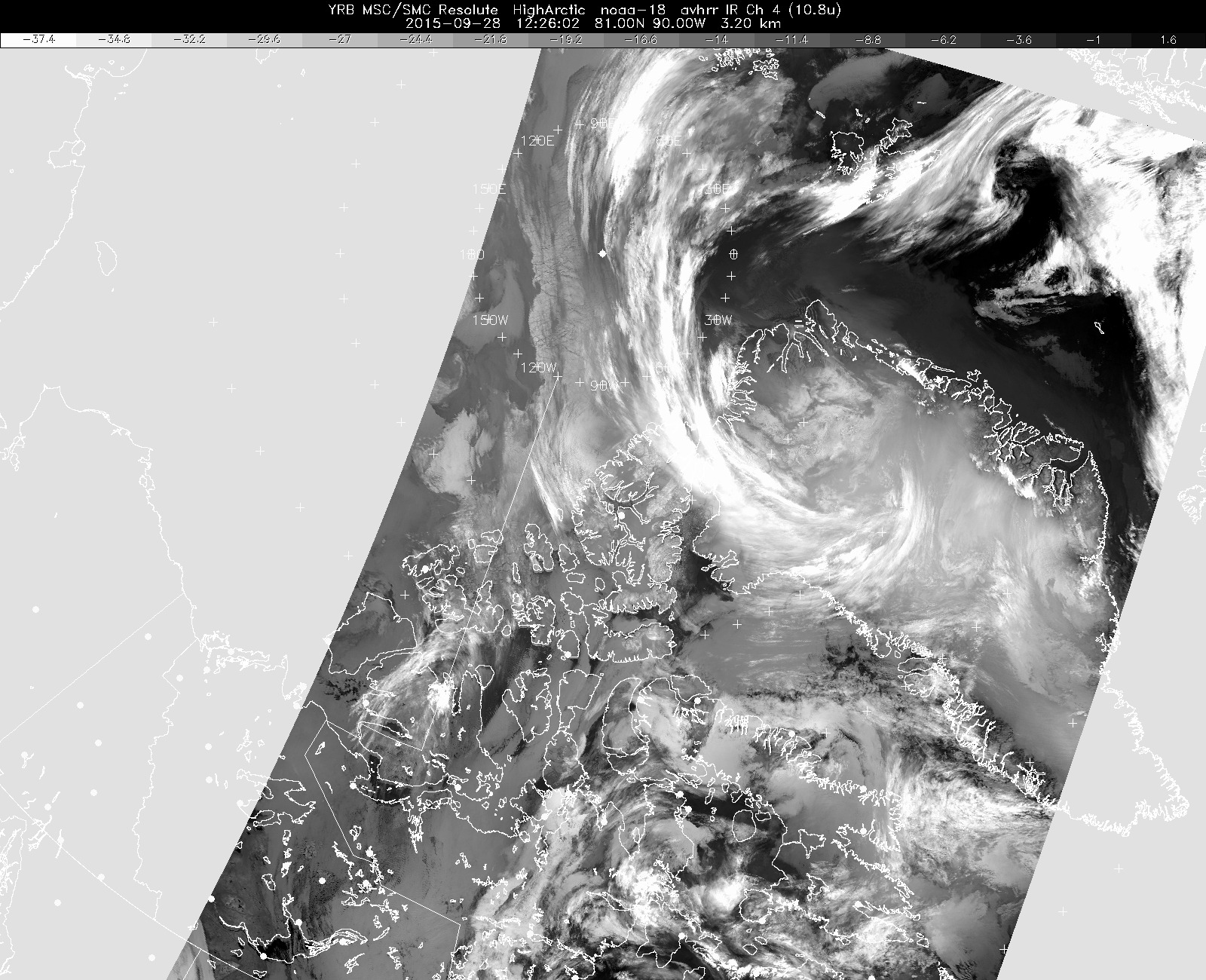
The latest infrared weather satellite image available to us before takeoff today. It shows the characteristic comma-shaped cirrus clouds surrounding the west side of the low-pressure system over northern Greenland, and widespread clouds and fog almost everywhere over northern Greenland and over our sea ice science targets. However, sea ice features are visible in a narrow strip north of Ellesmere Island, and that small clear area is where we flew today.
Credits
Environment Canada
Subject
Mission