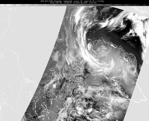
The latest infrared weather satellite image available to us before takeoff today. It shows the characteristic comma-shaped cirrus clouds surrounding the west side of the low-pressure system over northern Greenland, and widespread clouds and fog almost everywhere over northern Greenland and over our sea ice science targets. However, sea ice features are visible in a narrow strip north of Ellesmere Island, and that small clear area is where we flew today.
Weather satellite image from this morning
Credits
Environment Canada
Subject
Mission
Disclaimer: This material is being kept online for historical purposes. Though accurate at the time of publication, it is no longer being updated. The page may contain broken links or outdated information, and parts may not function in current web browsers. Visit https://espo.nasa.gov for information about our current projects.


