Infrared satellite weather image

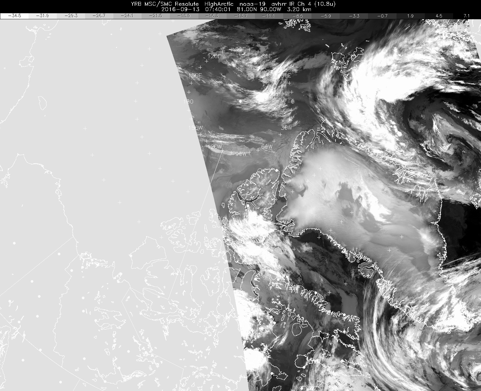
Infrared (hence temperature- and altitude-sensitive) weather satellite image of Greenland from 0540 local time this morning, showing the storm systems to the south and to the northeast, and the resulting low (warm/gray) and high (cold/bright white) clouds.

Credits
Environment Canada
Subject
Mission


Disclaimer: This material is being kept online for historical purposes. Though accurate at the time of publication, it is no longer being updated. The page may contain broken links or outdated information, and parts may not function in current web browsers. Visit https://espo.nasa.gov for information about our current projects.