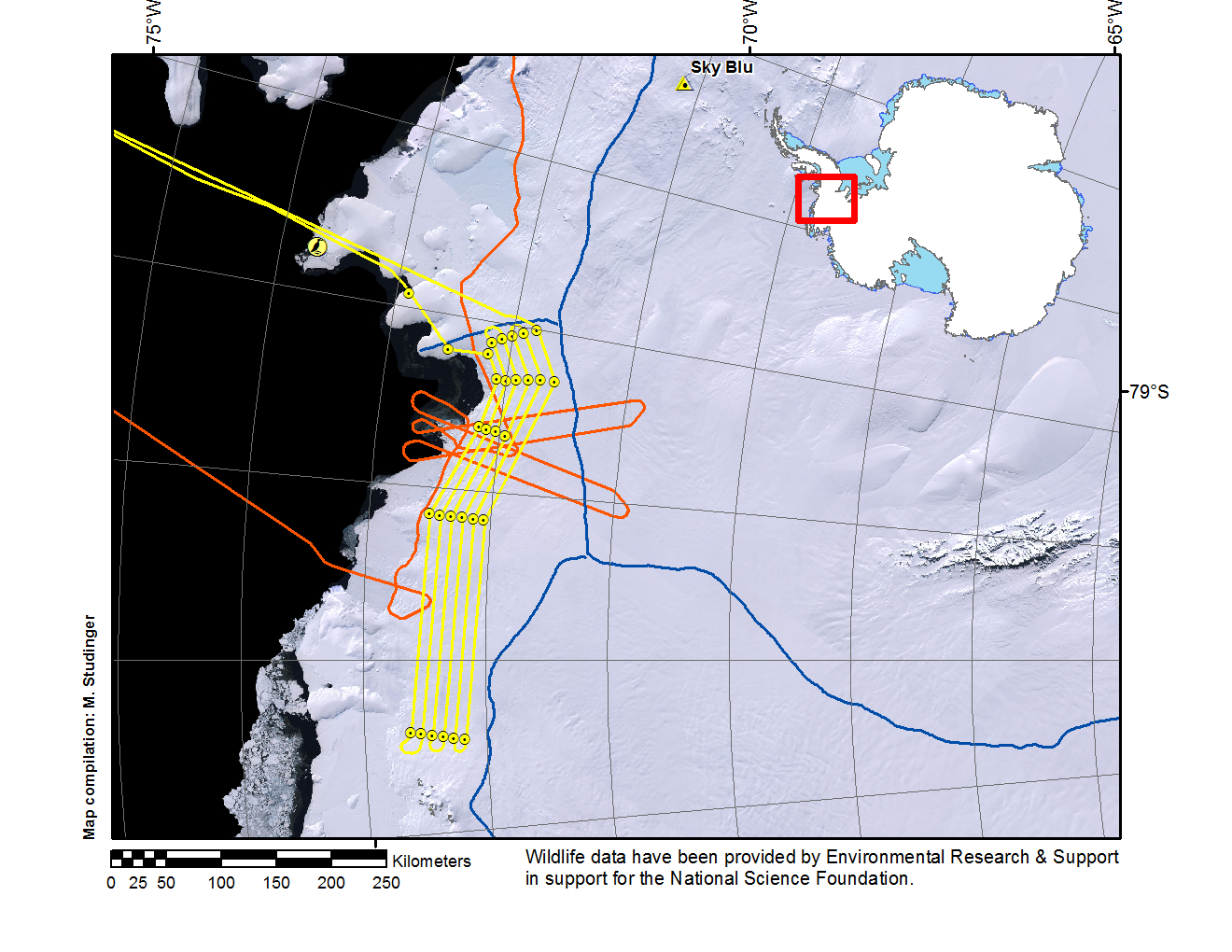
Trajectory of today’s science mission along the coast covering the Ferrigno and Alison Ice Streams (yellow line). Red line marks trajectory from missions in previous year's along four ICESat tracks over Ferrigno Ice Stream. Blue lines mark ice divides. Wildlife data have been provided by Environmental Research & Support in support for the National Science Foundation.
Credits
NASA/Michael Studinger
Subject
Aircraft
Mission