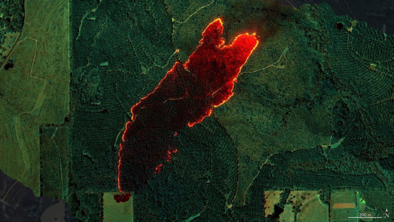
Data from the AVIRIS-3 sensor was recently used to create detailed fire maps in minutes, enabling firefighters in Alabama to limit the spread of wildfires and save buildings. A NASA sensor recently brought a new approach to battling wildfire, providing real-time data that helped firefighters in the field contain a blaze in Alabama. Called AVIRIS-3, which is short for Airborne Visible Infrared Imaging Spectrometer 3, the instrument detected a 120-acre fire on March 19 that had not yet been reported to officials.
Mission