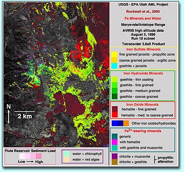
This is an example of research conducted by the United States Geological Survey using AVIRIS data. The image is an Fe(Iron)-bearing mineral map (0.35 to 1.35 micron spectral region) in the Antelope Range derived from Tetracorder analysis of AVIRIS data. (Please refer to this AVIRIS Workshop paper for more information regarding the above mineral map.)
Subject
Instrument