Disclaimer: This material is being kept online for historical purposes. Though accurate at the time of publication, it is no longer being updated. The page may contain broken links or outdated information, and parts may not function in current web browsers. Visit https://espo.nasa.gov for information about our current projects.


Geostationary Imaging Fabry-Perot Spectrometer (GIFS)

Status

Operated By: 
PI

Nadir image taken with the GIFS prototype instrument on board the NASA P3 near Wallops Island, VA, on Feb. 1, 2008. This 400x400-m image of clouds, taken from 21,000 ft, has a spatial resolution of 0.8 m. Concentric circles or rings on the image correspond to different wavelengths of light, with the two dark rings due to molecular oxygen absorption lines near 685 nm. By tuning the interferometer etalons, a sequence of images scans very high-resolution spectral features that contain information about cloud optical properties at every pixel of the image.

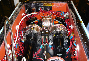
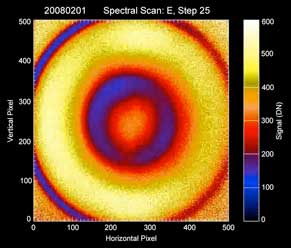
The GIFS instrument, a tunable triple-etalon Fabry-Perot Imaging Spectrometer, is designed to measure the O2 absorption lines in solar radiation reflected off the Earth’s surface. This optical technique can provide data to characterize cloud properties in 2 dimensions. The instrument also potentially provides measurements with spatial resolution, spatial coverage, revisit time, and precision/accuracy that would be difficult to obtain with existing methods.

The instrument enables measurements of cloud top temperature, pressure and altitude on a global scale, when deployed in geostationary orbit. Introduction of these data points into weather forecasting models will lead to significant improvements in the forecasting of weather events, including hurricane motion and intensity. The GIFS instrument successfully flew and operated on-board a NASA P-3 Orion in multiple flights throughout January and February 2008.

Instrument Type: 
Measurements: 
Aircraft: 
Point(s) of Contact: 
Sam Yee (POC; PI)