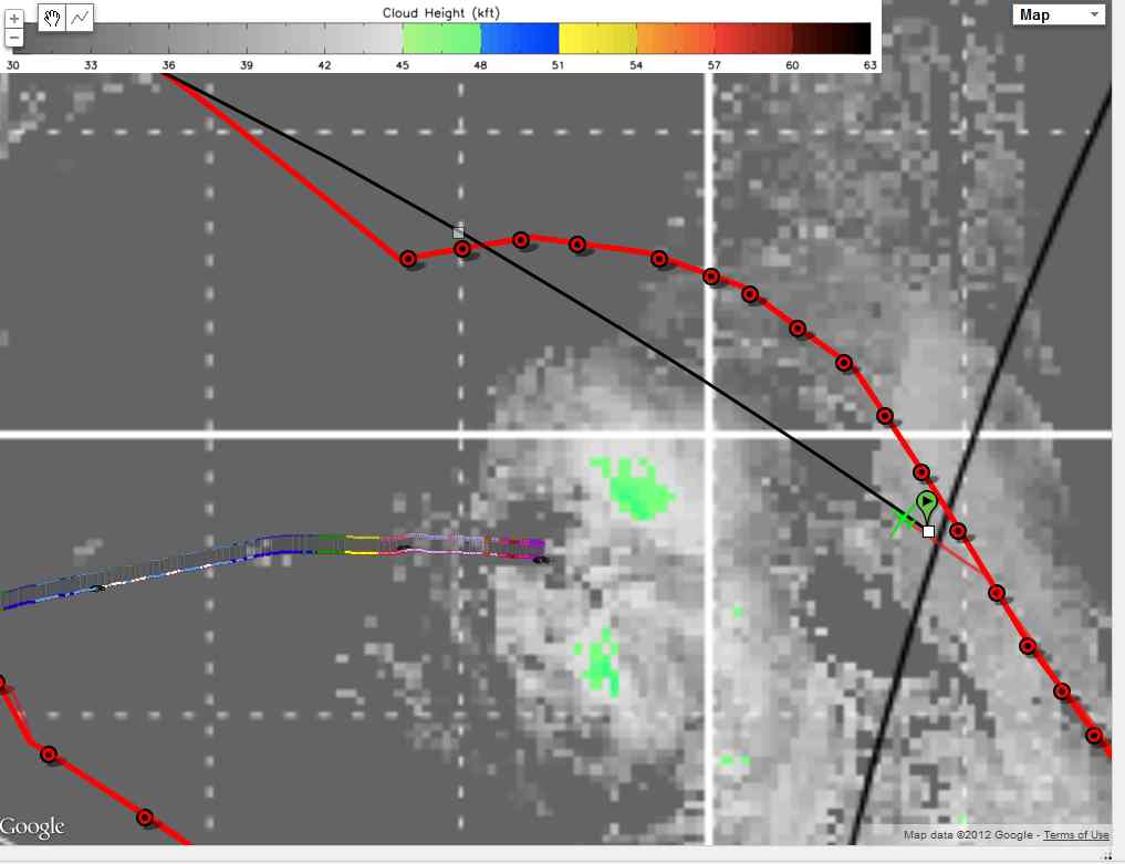
Image at 1145 UTC shows the approximate route home (black line) relative to cloud-top height data
Subject
Aircraft
Mission
Image at 1145 UTC shows the approximate route home (black line) relative to cloud-top height data
Disclaimer: This material is being kept online for historical purposes. Though accurate at the time of publication, it is no longer being updated. The page may contain broken links or outdated information, and parts may not function in current web browsers. Visit https://espo.nasa.gov for information about our current projects.
![]()