Status
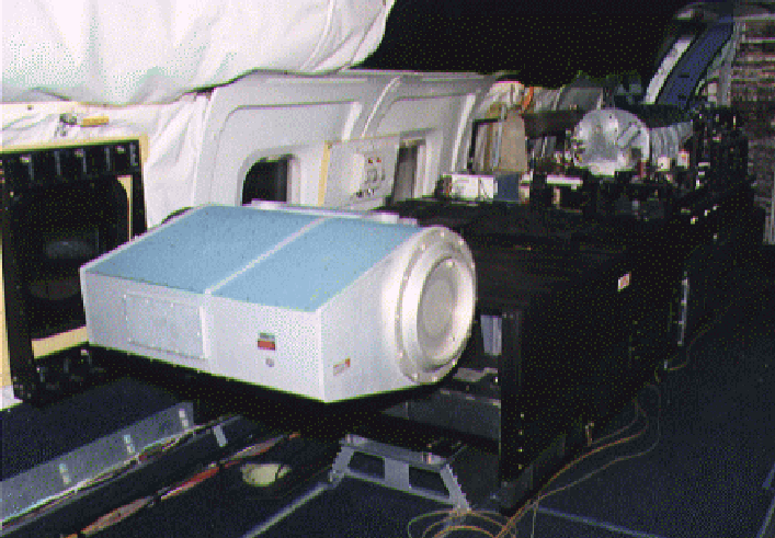
MACAWS is an airborne side-scanning Doppler laser radar (lidar) which measures two dimensional wind fields, vertical wind profiles, and aerosol backscatter from clear air and clouds. Range varies from 10-30 km depending on aerosol abundance and cloud attenuation. Upon exiting the aircraft, the lidar beam is completely eye-safe. MACAWS is developed and operated cooperatively by the atmospheric lidar remote sensing groups of NASA Marshall Space Flight Center, NOAA Environmental Technology Laboratory, and Jet Propulsion Laboratory.
MACAWS consists of: a frequency-stable pulsed transverse-excited atmospheric pressure carbon dioxide laser emitting 0.5-1.0 J per pulse at 10.6 micron wavelength at a nominal pulse repetition frequency (PRF) of ~20 Hz; a coherent receiver employing a cryogenically-cooled HgCdTe detector; a 0.3 m off-axis paraboloidal telescope shared by the transmitter and receiver in a monostatic configuration; a ruggedized optical table and three-point support structure; a scanner using two counter-rotating germanium wedges to refract the transmitted beam in the desired direction; an inertial navigation system (INS) for frequent measurements of aircraft attitude and speed; data processing, display, and storage devices; and an Operations Control System (OCS) to coordinate all system functions.