Airborne Science Mission Tool Suite
Go to the Airborne Science Mission Tools Suite
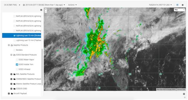
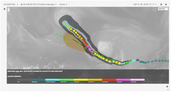
The NASA Airborne Science Mission Tool Suite supports the Airborne Science Program (ASP) and the NASA Science Mission Directorate (SMD) Earth Science Division by providing a suite of web-based capabilities to support Airborne Science Missions. ASP Mission Tool Suite is the ground complement to the NASA SensorNet project, which is developing the airborne networking infrastructure to enable high speed SATCOM of aircraft parameter data, and instrument data during flight missions. The ASP Mission Tools Suite provides a common operating picture for improved situational awareness for all participants in NASA Airborne Science missions from scientists and engineers, to managers, as well as the general public. The intent of the system is to encourage more responsive and collaborative measurements between instruments on multiple aircraft, satellites, and on the surface in order to increase the scientific value of the measurements, and improve the efficiency and effectiveness of flight missions. At its most basic, ASP Mission Tool Suite provides a means for visualizing the position of the aircraft and instruments during the course of the mission. Such information is made more useful when compared with or overlaid upon other datasets and model outputs used for mission planning and science data analysis. Additionally, ASP Mission Tool Suite facilitates communication between mission team members to enable analysis and discussion of multiple data sources to help plan and execute science missions.
The ASP Mission Tool Suite contains a core set of tools that provide Airborne Science Participants with a host of capabilities:
- remotely monitor real-time aircraft location
- view current and archived aircraft flight tracks
- ability to add information overlays from a curated product registry
- customized user workspaces
- communication and collaboration tools
- integrated IRC client supporting multiuser and person-to-person private chat
- remotely monitor real-time instrument engineering data
- plotting and graphing
- and more...
Screenshots