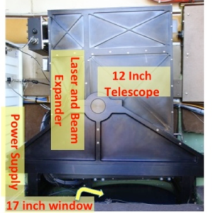
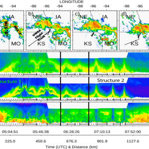
CRL can provide simultaneous water vapor, temperature, aerosol, and cloud profiles within the planetary boundary layer (PBL) from UWKA, NSF/NCAR C-130, and NOAA P-3. It uses a compact, lightweight transmitting-receiving system (12-inch telescope). Although the 50-mJ CRL laser limits water vapor measurement to short-range under high solar background conditions, past CRL measurements demonstrated that CRL measurements offer excellent measurements to characterize PBL structures from airborne platforms. CRL enhances PBL observations at horizontal resolutions ranging from ~100 m to ~1 km and can revolutionize a range of atmospheric processes studies. These include: advancing our understanding of small-scale interactions between clouds and their environment, investigating air-sea and air-land interactions; documenting boundary layer structure over heterogeneous surfaces and under cloudy conditions; examining the mesoscale atmospheric environments and dynamics.
Compact Raman Lidar
Instrument Type
Measurements
Recent Missions
(WP-3D Orion - NOAA)
(University of Wyoming King Air)
(WP-3D Orion - NOAA)
(WP-3D Orion - NOAA)
(University of Wyoming King Air)
Point(s) of Contact
(POC; PI)
Range of Measurement
Vertical profile
Instrument Pointing
Zenith (directly upwards)Nadir (directly downwards)
Measurement Sampling Rate
5.00 Hz
Vertical Resolution
0.60 m
Data Delivery
Realtime for preliminary data; final data within a month
Weight
75.00 kg
Power:
(maximum )
1000.00 W
1500.00 W
TRL
9
Publications
Geerts, B., et al. (2020), Interactions between a Nocturnal MCS and the Stable Boundary Layer as Observed by an Airborne Compact Raman Lidar during PECAN GUO LIN Department of Atmospheric and Oceanic Sciences, and Laboratory for Atmospheric and Space Physics, University of Colorado, Mon. Wea. Rev., 147, 3169-3189, doi:10.1175/MWR-D-18-0388.1.
Disclaimer: This material is being kept online for historical purposes. Though accurate at the time of publication, it is no longer being updated. The page may contain broken links or outdated information, and parts may not function in current web browsers. Visit https://espo.nasa.gov for information about our current projects.


