Disclaimer: This material is being kept online for historical purposes. Though accurate at the time of publication, it is no longer being updated. The page may contain broken links or outdated information, and parts may not function in current web browsers. Visit https://espo.nasa.gov for information about our current projects.


Synonyms: 
UC-12B - LARC
UC-12B
UC-12
UC12B
UC12
Associated content: 

UC-12 and Lear in Ponca City, OK

In Situ Airborne Formaldehyde

The NASA GSFC In Situ Airborne Formaldehyde (ISAF) instrument measures formaldehyde (CH2O) on both pressurized and unpressurized (high-altitude) aircraft. Using laser induced fluorescence (LIF), ISAF possesses the high sensitivity, fast time response, and dynamic range needed to observe CH2O throughout the troposphere and lower stratosphere, where concentrations can range from 10 pptv to hundreds of ppbv.

Formaldehyde is produced via the oxidation of hydrocarbons, notably methane (a ubiquitous greenhouse gas) and isoprene (the primary hydrocarbon emitted by vegetation). Observations of CH2O can thus provide information on many atmospheric processes, including:
 - Convective transport of air from the surface to the upper troposphere
 - Emissions of reactive hydrocarbons from cities, forests, and fires
 - Atmospheric oxidizing capacity, which relates to formation of ozone and destruction of methane
In situ observations of CH2O are also crucial for validating retrievals from satellite instruments, such as OMI, TROPOMI, and TEMPO.

Instrument Type: 
Measurements: 
Aircraft: 
Point(s) of Contact: 

B-200 (UC-12B) - LARC

NASA Langley Beechcraft  UC-12B Huron (NASA 528)

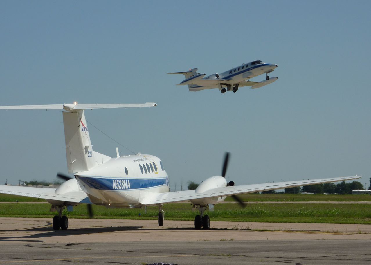
The NASA Langley Beechcraft UC-12B Huron (NASA 528) is an all-metal, twin-turboprop research aircraft.  The UC-12B aircraft is a military version of a Beechcraft B200 King Air.  NASA Langley acquired this aircraft in 2007 from the U.S. Marine Corps.  The aircraft has been modified with two nadir-viewing ports:  29.5 x 29.5-in. in the forward section of the passenger cabin and 26.75 x 22.5 in. in the aft section.  These downward-looking portals allow the use of a wide variety of optical, laser, or R-F based devices that might require a nadir look angle out of the aircraft.  Research-supporting subsystems, such as electrical power distribution, TCAS, GPS and satellite phone communications also have been installed.  The UC-12B aircraft also has a cargo door in the aft left side of the passenger cabin that can accommodate payloads up to 51.5 in. wide.  In past operations, the cargo door has allowed a forklift with a boom attachment to place large, heavy payloads directly into the aircraft cabin.  In its current configuration, the aircraft serves as the primary flight platform for a suite of aerosol and cloud remote-sensing instruments, including the NASA Langley Doppler Aerosol Wind LIDAR (DAWN).  The aircraft is fully IFR capable.
 

The ship’s starter generators have recently been upgraded from 250 A to 300 A, thereby increasing research power capacity from 4200 to 8400 W @ 28 VDC.  An Iridium satellite phone system has been installed to facilitate both remote voice communications as well as data modem transfer.
 

This aircraft nominally flies mission profiles up to altitudes of 28,000 ft, but with prior coordination, is capable of conducting operations in the National Airspace System up to the aircraft's service ceiling of 31,000 ft.  Typically, the aircraft can carry a 1000-lbs payload, three crewmembers (two flight crew and one system operator) and remain airborne for four hours covering approximately 800 n.mi.  The aircraft is limited to a maximum certified takeoff weight of 13,500 lbs.  The aircraft has successfully operated in both domestic and international deployments.  In summary, the NASA Langley UC-12B aircraft and its flight team provide an efficient and effective operational platform for small to medium-sized science payloads, especially those requiring or desiring unique integration, dedicated flight profiles, coordinated flights with other platforms, or flight patterns in congested airspace.

Current Status:
Open
Owner/Operator: 
NASA Langley Research Center
Type: 
Conventional Aircraft
Duration: 
6.2 hours (payload and weather dependent)
Useful Payload: 
4 100 lbs
Gross Take-off Weight: 
13 500 lbs
Onboard Operators: 
4
Max Altitude: 
31000 ft
Air Speed: 
260 knots
Range: 
1 250 Nmi
Point(s) of Contact: 

Bruce Fisher

Work: (757) 864-3862

Doppler Aerosol WiNd Lidar

The NASA Langley Research Center DAWN (Doppler Aerosol WiNd) lidar system employs a pulsed, solid-state laser operating at 2053 nm wavelength. It pulses at 10 Hz with up to 100 mJ/pulse which are 180 ns long. Using a wedge scanner, several different azimuth angles can be measured below the aircraft, all at a 30 degree off-nadir angle. Multiple azimuth angles enable horizontal wind calculation, mitigate cloud obscurations, and measure atmospheric variability. DAWN can provide vertical profiles of the zonal (u) and meridional (v) components of the horizontal wind below the aircraft, typically at ~60 meter resolution. Various vertical and horizontal resolutions are possible in post processing. DAWN can also provide vertical profiles of line of sight (LOS) wind speed at each azimuth angle. It can also be operated to stare persistently at any particular azimuth angle to simulate what a satellite such as European Space Agency Atmospheric Dynamics Mission (ADM) Aeolus would observe. DAWN signal returns also permit retrieval of vertical profiles of relative aerosol backscatter, planetary boundary layer height, and wind turbulence.

Instrument Type: 
Point(s) of Contact: 

Multi-functional Fiber Laser Lidar

The MFLL is an airborne lidar system, a single-beam multi-pixel laser altimeter using PRN (Pseudo Random Noise) modulated fiber lasers. The instrument has been developed under a NASA ESTO (Earth Science Technology Office) IIP (Instrument Incubator Program) grant for Climate Change research and Exploration. The major goal of MFLL is to demonstrate the required lidar technology concept for the LAS (Laser Absorption Spectrometer) to be flown on the future spaceborne ASCENDS (Active Sensing of CO2 Emissions over Nights, Days, and Seasons) mission of NASA. The airborne MFLL is the prototype of the future LAS instrument, it is also referred to as ITT's CO2 EDU (Engineering Development Unit) for ASCENDS. ITT Geospatial Systems of Fort Wayne, Indiana is the developer of the instrument. NASA/LaRC (Langley Research Center) in Hampton, VA is the operator of the MFLL instrument and is providing flight data analysis.

Instrument Type: 
Measurements: 
Point(s) of Contact: 

Pages

Subscribe to RSS - B-200 (UC-12B) - LARC