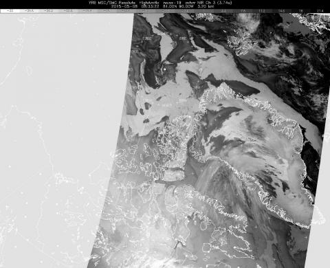
Weather satellite image from this morning
The 3-micron "water vapor" satellite image from this morning. Water vapor, and particularly fog this time of year, shows up as dark gray or black in this part of the electromagnetic spectrum. This image shows a large area clear of fog in the Lincoln Sea and points west. The accompanying visible-wavelenth image showed a few high thin cirrus clouds (composed of ice crystals, not water vapor) over the same area, and the infrared image showed the thin cirrus clouds as well, and also showed surface texture and leads in the sea ice under the cirrus. Careful attention to all three spectral bands is required to correctly interpret satellite weather imagery near the poles - and to avoid nasty meteorological surprises.
Credits:
Environment Canada
Subject:
Mission:

