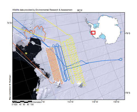
Trajectory of today’s science mission over Thwaites Glacier
Trajectory of today’s science mission over Thwaites Glacier grounding line in yellow. Previous missions are shown with different colors. Together, the missions result in a 2.5 km grid over the grounding area and 5 km upstream. The data is intended as input for ice sheet models. Background image is true color Landsat Image Mosaic of Antarctica (LIMA). Known wildlife locations are indicated by bird symbols. Wildlife data have been provided by Environmental Research & Support in support for the National Science Foundation.
Credits:
NASA/Michael Studinger
Subject:
Aircraft:
Mission:

