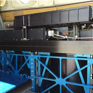
MARLi was an NSF-MRI funded new instrument development to provide water vapor, temperature, aerosol, and cloud profiles within the planetary boundary layer (PBL). MARLi was successfully flight-tested on the UWKA and the NSF/NCAR C-130 for over sixty-hours in the summer of 2016.
MARLi transforms our capability to observe the atmosphere at horizontal resolutions ranging from ~100 m to ~1 km and can revolutionize a range of atmospheric processes studies. These include: advancing our understanding of small-scale interactions between clouds and their environment, investigating air-sea and air-land interactions; documenting boundary layer structure over heterogeneous surfaces and under cloudy conditions; examining the mesoscale atmospheric environments and dynamics.
Multi-function Airborne Raman Lidar
Instrument Type
Measurements
Recent Missions
(P-3 Orion - WFF)
Point(s) of Contact
(POC; PI)
Range of Measurement
Vertical profile
Instrument Pointing
Zenith (directly upwards)Nadir (directly downwards)
Measurement Sampling Rate
10.00 Hz
Vertical Resolution
0.60 m
Data Delivery
Realtime for preliminary data; final data within a month
Weight
300.00 kg
TRL
8
Disclaimer: This material is being kept online for historical purposes. Though accurate at the time of publication, it is no longer being updated. The page may contain broken links or outdated information, and parts may not function in current web browsers. Visit https://espo.nasa.gov for information about our current projects.


