This site requires that JavaScripts be enabled in your browser. For instructions,
click here
Skip to main content
NASA - National Aeronautics and Space Administration
You must have JavaScript enabled to use this form.
›
Log in to IMPACTS
|
›
Create New Account
Log in to IMPACTS
Username
*
Password
*
Create new account
Request new password
Search form
Search
Leave this field blank
ESPO
Missions
About ESPO
Video about ESPO
Services
Deployment Sites
Aircraft
Satellites
Links
ESPO Archive
Browse
Help
Flight Request
Mission Tools
ASP Mission Tool Suite
IMPACTS Home
Mission Planning
Science
Science Overview
2023 Data Workshop
2022 Virtual Data Workshop
STM 2022
Platforms
Airborne
Instruments
News
Shared Files
2023 Field Catalog
2022 Field Catalog
2020 Field Catalog
IMPACTS
Home
> Data
Image displaying measurement data
C-HARRIER Flight Track 191119 (PM local)
Read more
about C-HARRIER Flight Track 191119 (PM local)
C-HARRIER Flight Track 191119 AM
Read more
about C-HARRIER Flight Track 191119 AM
C-HARRIER Flight Track 191119 AM
Read more
about C-HARRIER Flight Track 191119 AM
C-HARRIER Flight Track 11/18/2019
Read more
about C-HARRIER Flight Track 11/18/2019
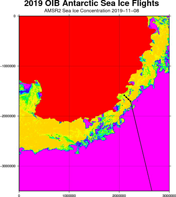
Today's planned flightline (black) overlaid on a recent AMSR-2 sea ice concentration image, with Antarctica in red, and open water in magenta; we use this product on a regular basis to fine-tune our sea ice flight plans
Read more
about Today's planned flightline (black) overlaid on a recent AMSR-2 sea ice concentration image, with Antarctica in red, and open water in magenta; we use this product on a regular basis to fine-tune our sea ice flight plans
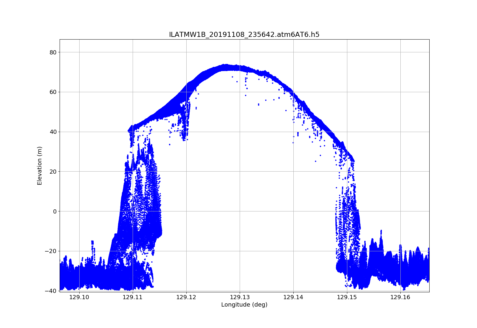
ATM T-6 profile of the thick icebergs
Read more
about ATM T-6 profile of the thick icebergs
Figure 4
Read more
about Figure 4
Figure 5
Read more
about Figure 5
Figure 4
Read more
about Figure 4
Figure 8
Read more
about Figure 8
Pages
« first
‹ previous
…
4
5
6
7
8
9
10
11
12
…
next ›
last »

")