
Flight plan and track detail
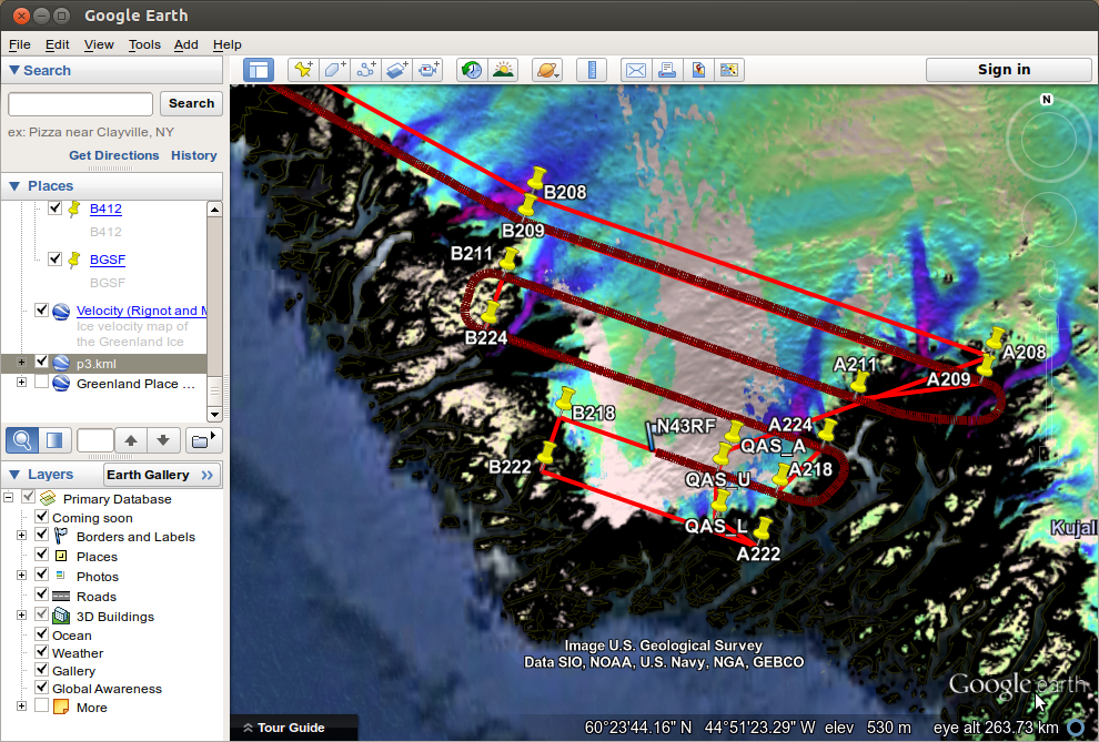
Google Earth real-time screenshot of our flight lines over the extreme southwestern lobe of the Greenland ice sheet. Three of the PROMICE sites are depicted as waypoints QAS_L, QAS_U and QAS_A. The planned mission is shown in bright red, and the path flown up to this point in the mission in dark red.
Subject:
Mission: