
Disclaimer: This material is being kept online for historical purposes. Though accurate at the time of publication, it is no longer being updated. The page may contain broken links or outdated information, and parts may not function in current web browsers. Visit https://espo.nasa.gov for information about our current projects.
Weather satellite image from this morning
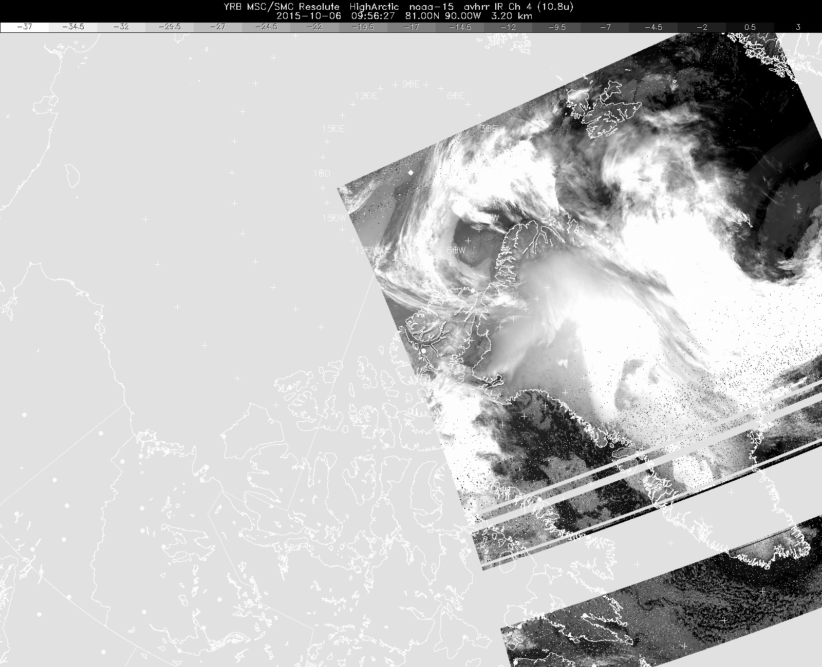
Infrared weather satellite image from this morning, showing cirrus clouds near Petermann Glacier and the compact low-pressure system in Melville Bay, with its associated low clouds covering the ice sheet inland. This image is from the NOAA-15 polar orbiter, and note that portions of the image are garbled. This is an ongoing problem with this particular weather satellite, and the resulting poor imagery has occasionally hampered our flight decision-making process.