This site requires that JavaScripts be enabled in your browser. For instructions,
click here
Skip to main content
NASA - National Aeronautics and Space Administration
You must have JavaScript enabled to use this form.
›
Log in to ESPO
|
›
Create New Account
Log in to ESPO
Username
*
Password
*
Create new account
Request new password
Search form
Search
Leave this field blank
ESPO
Missions
About ESPO
Video about ESPO
Services
Deployment Sites
Aircraft
Satellites
Links
ESPO Archive
Browse
Help
Flight Request
Mission Tools
ASP Mission Tool Suite
ESPO
Home
Missions
About ESPO
Video about ESPO
Services
Deployment Sites
Aircraft
Satellites
ESPO Archive
Flight Request
Mission Tools
Links
ESPO
Home
> ATM
Synonyms:
Airborne Topographic Mapper
Associated content:
Airborne Topographic Mapper
Figure 8
Read more
about Figure 8
Figure 7
Read more
about Figure 7
Figure 4
Read more
about Figure 4
Figure 2
Read more
about Figure 2
Figure 2
Read more
about Figure 2
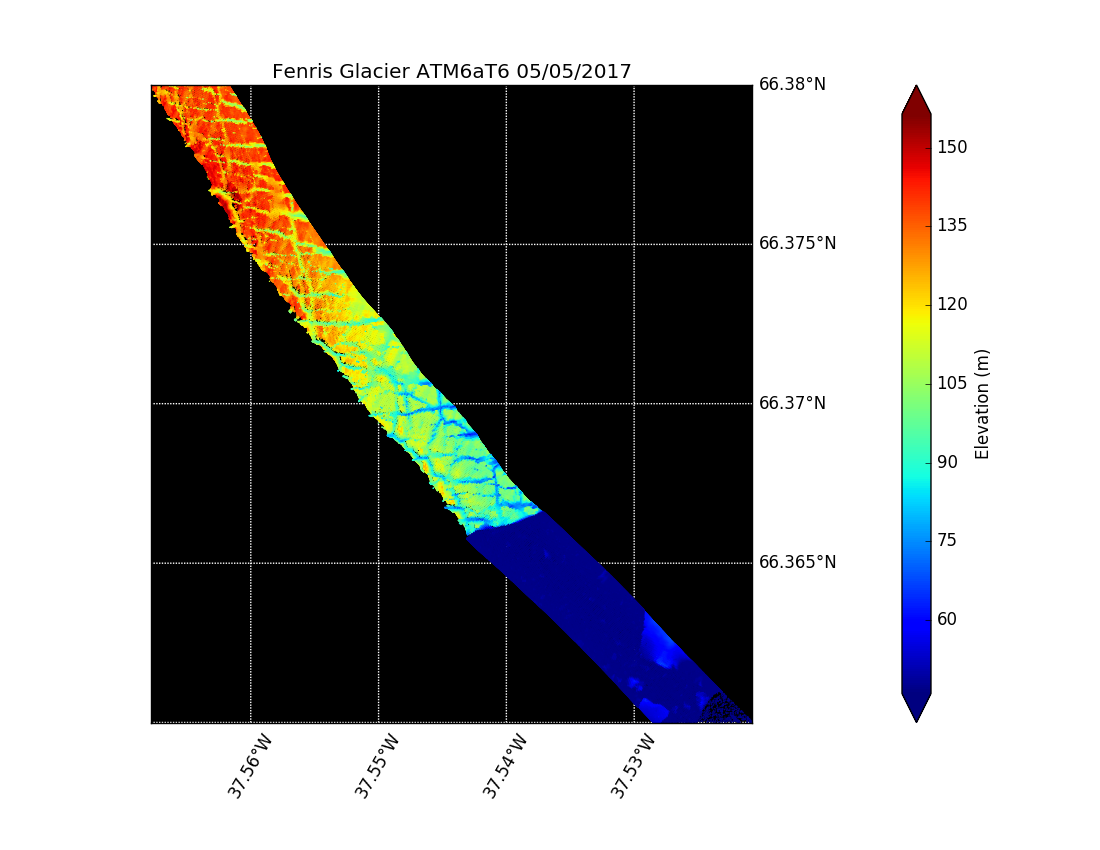
ATM T6 surface elevation along the calving front of Fenris Glacier
Read more
about ATM T6 surface elevation along the calving front of Fenris Glacier
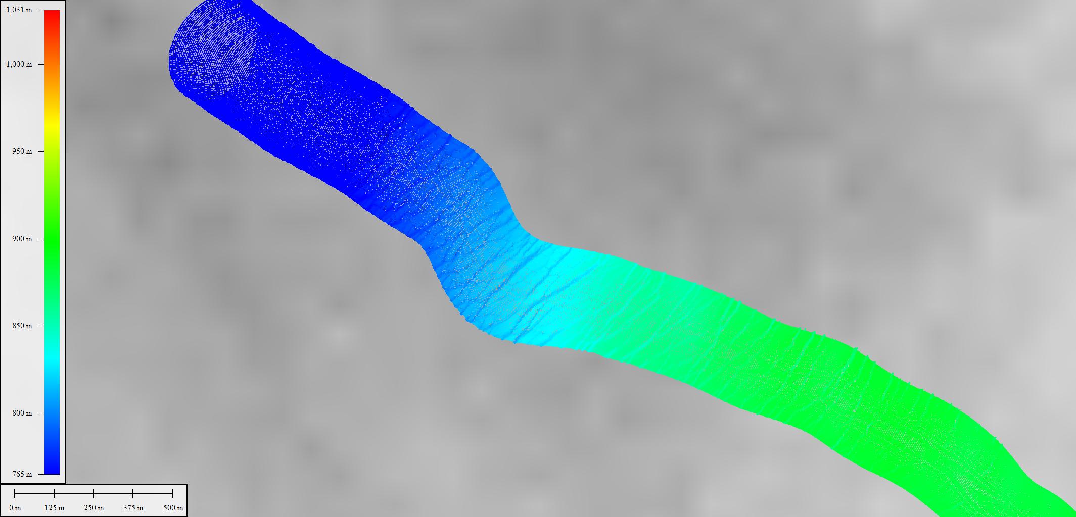
3-D animation of ATM T6 data collected over Sermilik Glacier
Read more
about 3-D animation of ATM T6 data collected over Sermilik Glacier
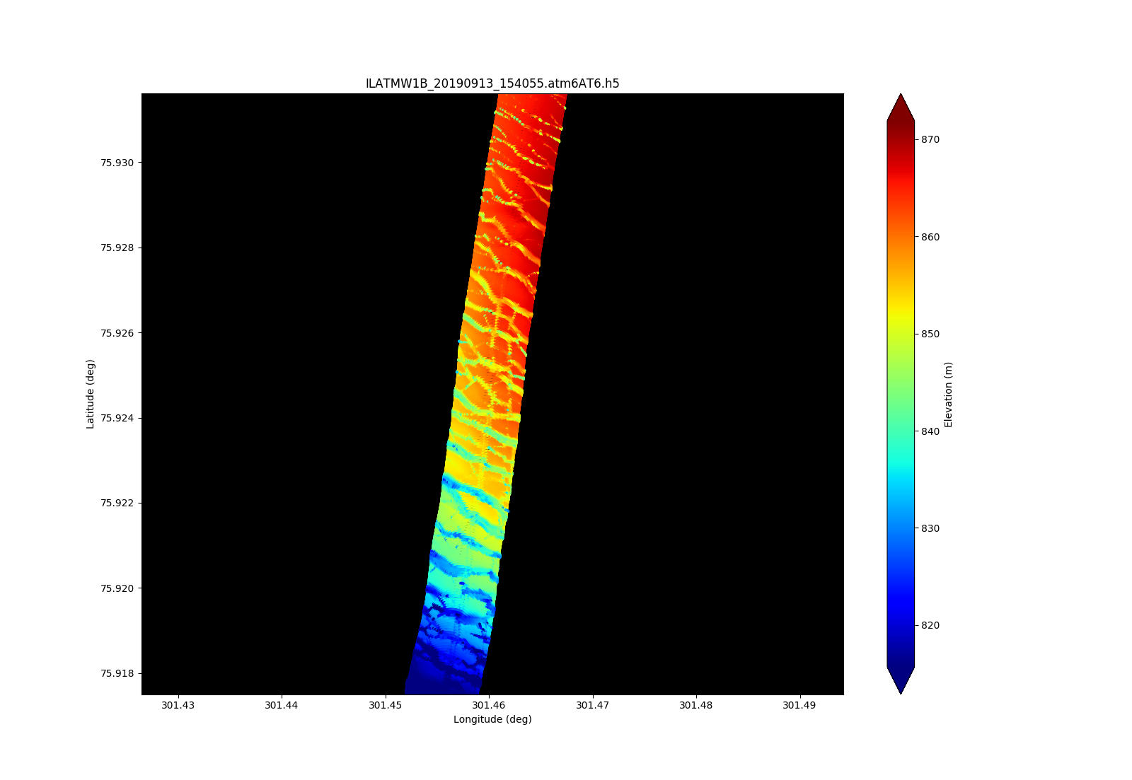
ATM T6 surface elevation over a crevasse field illustrating the higher shot density associated with the 10 kHz PRF
Read more
about ATM T6 surface elevation over a crevasse field illustrating the higher shot density associated with the 10 kHz PRF
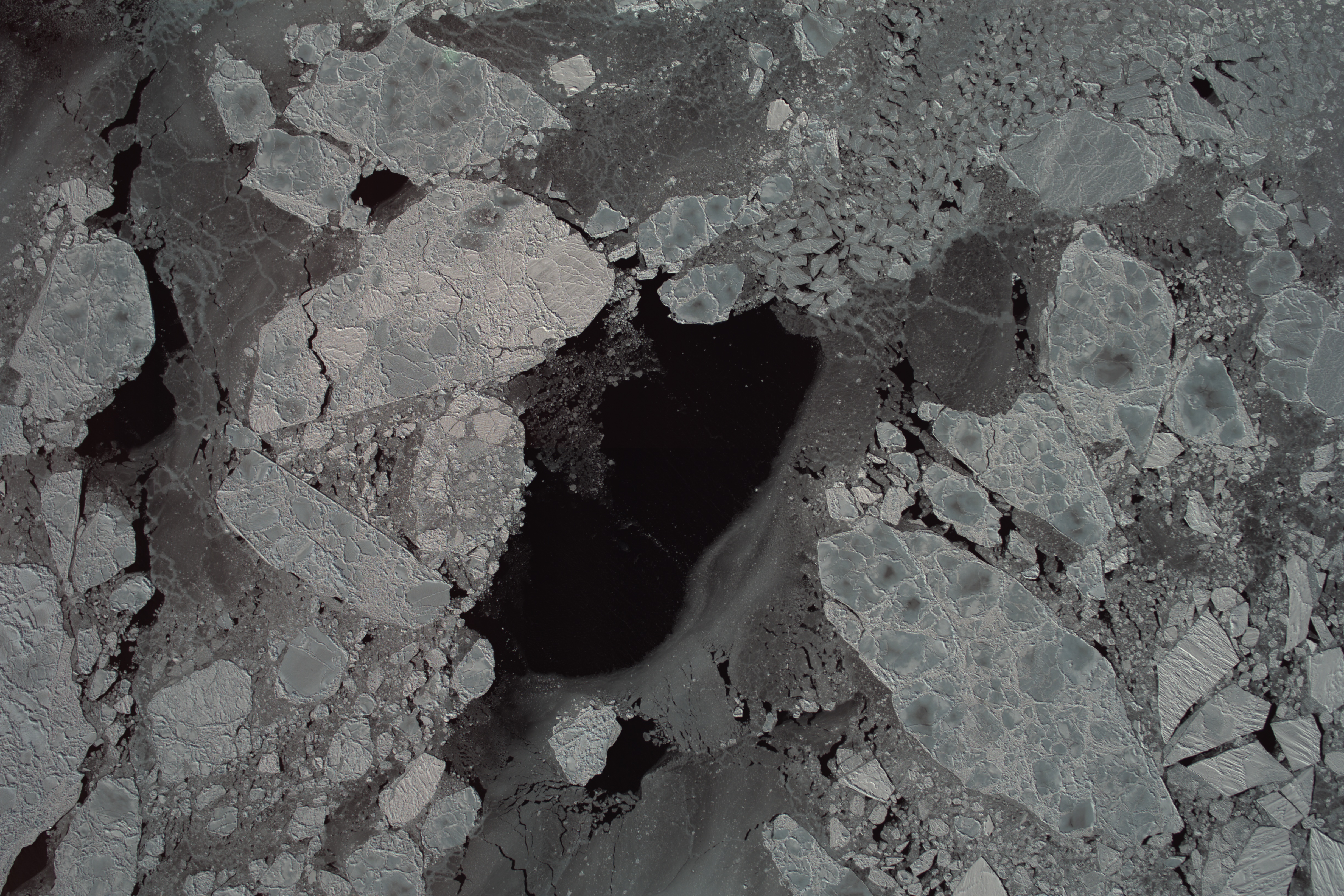
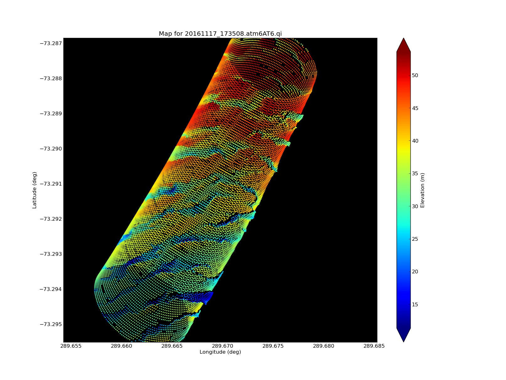
ATM T6 mapping of a crevasse field
Read more
about ATM T6 mapping of a crevasse field
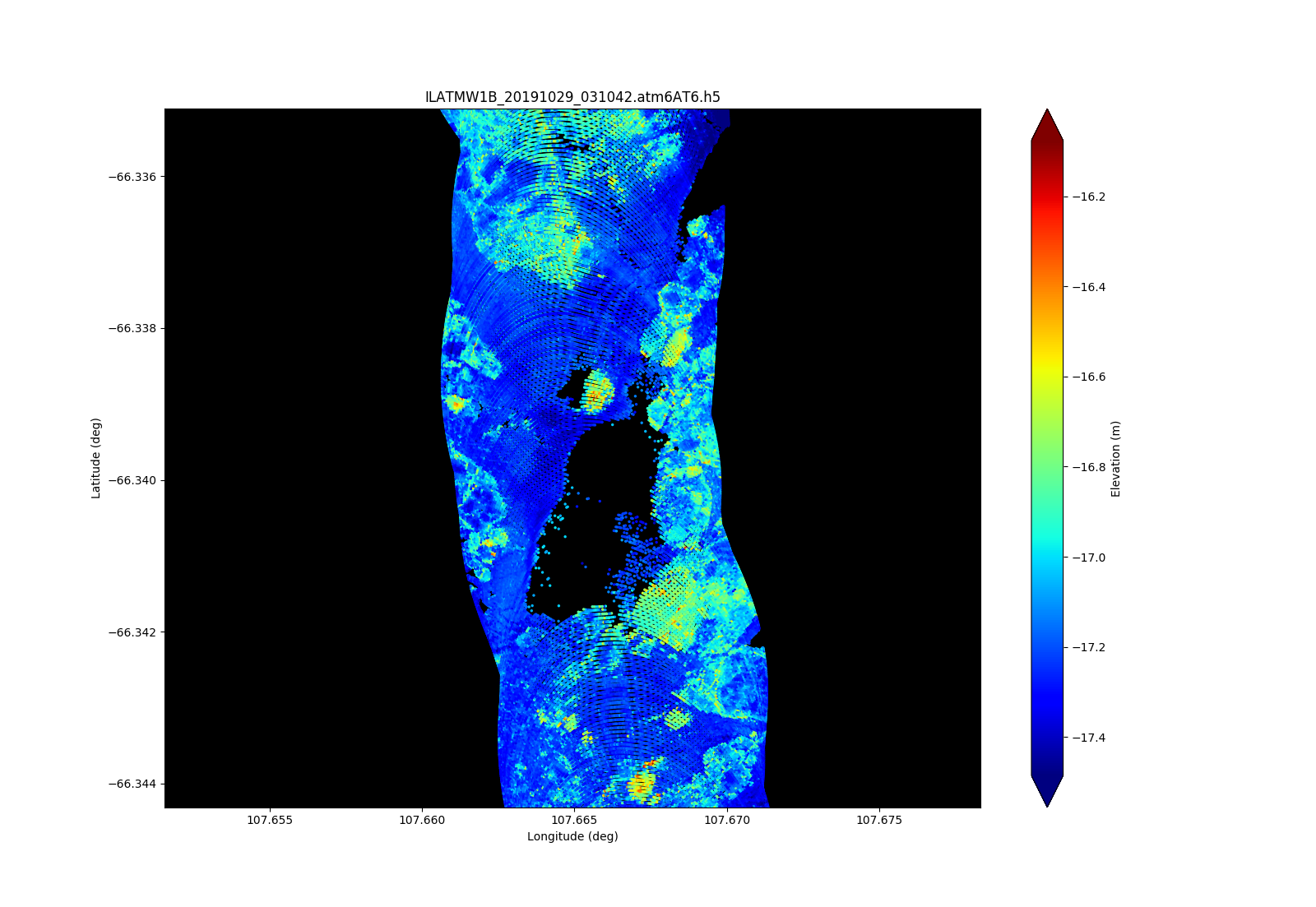
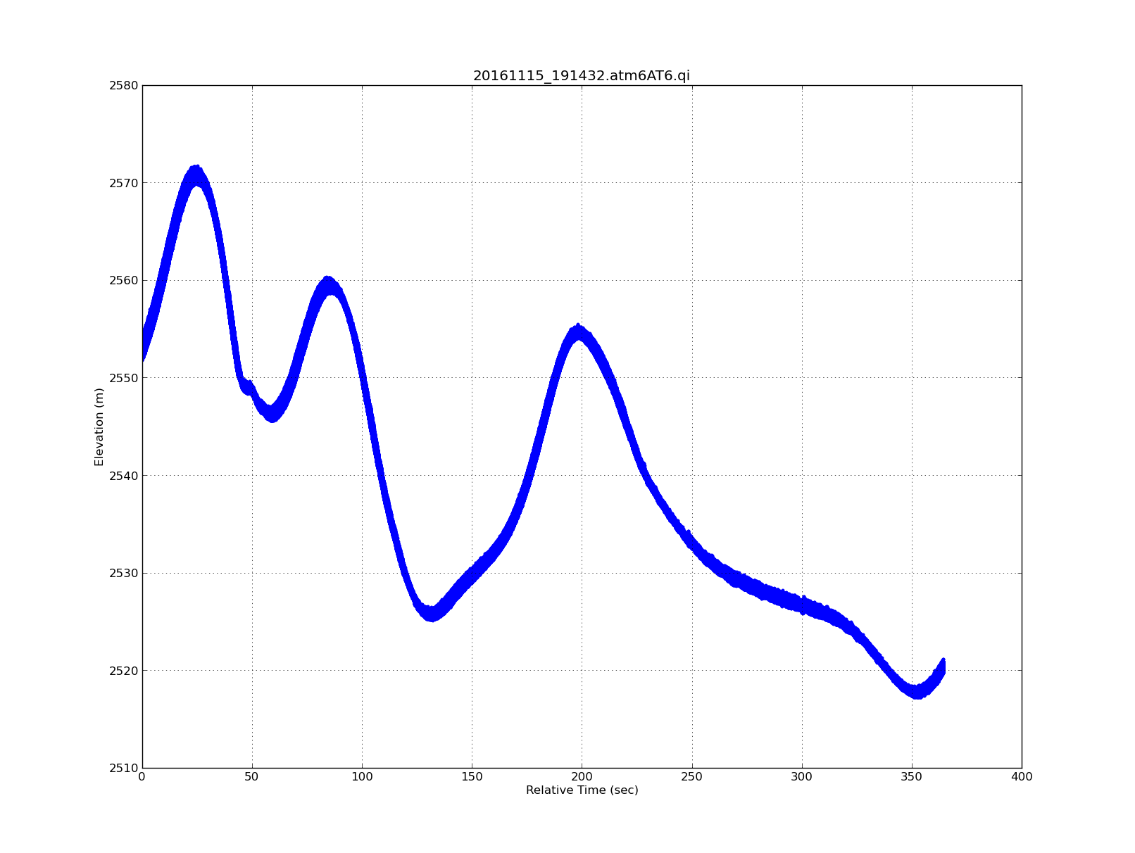
Elevation along the eastern portion of the pole hole
Read more
about Elevation along the eastern portion of the pole hole
Pages
1
2
next ›
last »