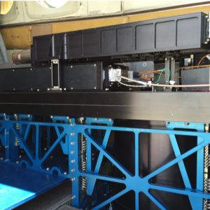
MARLi was an NSF-MRI funded new instrument development to provide water vapor, temperature, aerosol, and cloud profiles within the planetary boundary layer (PBL). MARLi was successfully flight-tested on the UWKA and the NSF/NCAR C-130 for over sixty-hours in the summer of 2016.
MARLi transforms our capability to observe the atmosphere at horizontal resolutions ranging from ~100 m to ~1 km and can revolutionize a range of atmospheric processes studies. These include: advancing our understanding of small-scale interactions between clouds and their environment, investigating air-sea and air-land interactions; documenting boundary layer structure over heterogeneous surfaces and under cloudy conditions; examining the mesoscale atmospheric environments and dynamics.
Multi-function Airborne Raman Lidar
Instrument Type
Measurements
Recent Missions
(P-3 Orion - WFF)
Point(s) of Contact
(POC; PI)
Range of Measurement
Vertical profile
Instrument Pointing
Zenith (directly upwards)Nadir (directly downwards)
Measurement Sampling Rate
10.00 Hz
Vertical Resolution
0.60 m
Data Delivery
Realtime for preliminary data; final data within a month
Weight
300.00 kg
TRL
8


